*Drone Surveying* is a cutting-edge service that can set *Precise Surveyors and Engineers* apart from competitors.
✈Drone Surveying & Aerial Mapping
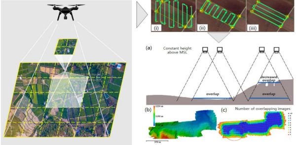
Fast, Accurate, and Cost-Effective Land Data Collection We use *high-resolution drones* equipped with *LiDAR, RGB cameras, and photogrammetry software* to capture precise aerial data for construction, mining, agriculture, and infrastructure projects.
Simply provide your details and one of our engineers or surveyors will respond shortly. And your detailed quote will be provided back in about a day and offers you an accurate and firm estimate.